| |
| |
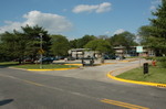
Caption: UIS Long Range Plan - 1970 (Sangamon State Univ)
This is a reduced-resolution page image for fast online browsing.

EXTRACTED TEXT FROM PAGE:
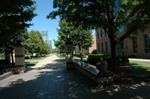
PART III 1 THE LONG RANGE DEVELOPMENT PLAN E. PEDESTRIAN AND BICYCLE CIRCULATION Pedestrian and Bicycle Circulation has been planned in such a way that most areas of the campus, approximately 500 acres east of the principal public road are accessible one to another on foot or by bicycle, free of any vehicular traffic. 1) Within the ring road, an area of approximately 175 acres, all areas of the academic campus, are accessible to the pedestrian without crossing any vehicular road. Bicycle lanes parallel most walks and are an added width to the walks. The walking time at 250f per minute, from Ring Road to Campus Center is 6-1/2 minutes. Outside the ring road, areas totaling approximately 325 acres plus the Lincoln Land College are accessible one to another and to the academic heart of the campus, free of auto traffic, by means of two pedestrian and bicycle overpasses and one pedestrian and bicycle underpass. Space for parking bicycles near all academic buildings is provided, some beneath shelter and some in the open. At the plaza level (Level 2) Elevation 596, deep arcades or cantilevered upper floors are provided for all buildings framing the plaza. These sheltered walks can enhance the comfort and pleasure of the central plaza. All walks, from parking lots to buildings, are of gentle slopes. The main floor of all buildings, Level 2, Elevation 596, is accessible either at the grade of the walks or with easy ramps from the walks. 2) 3) 4) 5) 6)
| |