Caption: UIS Long Range Plan - 1970 (Sangamon State Univ)
This is a reduced-resolution page image for fast online browsing.
EXTRACTED TEXT FROM PAGE:
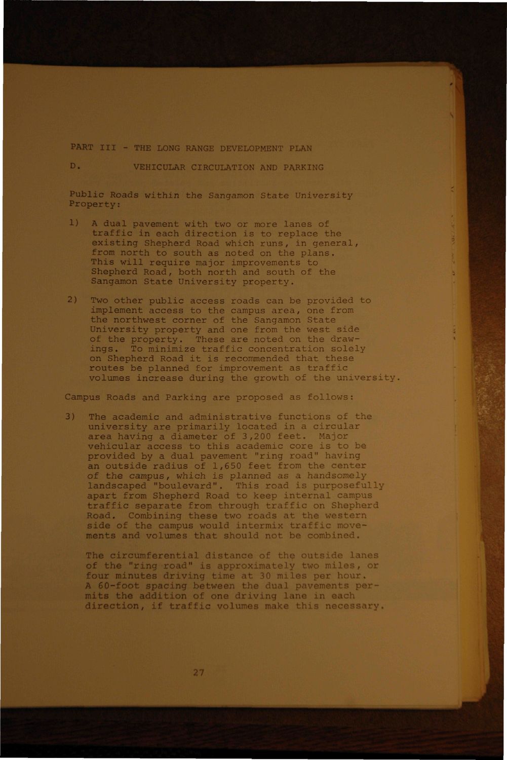
PART III | THE LONG RANGE DEVELOPMENT PLAN D. VEHICULAR CIRCULATION AND PARKING Public Roads within the Sangamon State University Property: 1) A dual pavement with two or more lanes of traffic in each direction is to replace the existing Shepherd Road which runs, in general, from north to south as noted on the plans. This will require major improvements to Shepherd Road, both north and south of the Sangamon State University property. Two other public access roads can be provided to implement access to the campus area, one from the northwest corner of the Sangamon State University property and one from the west side of the property. These are noted on the drawings. To minimize traffic concentration solely on Shepherd Road it is recommended that these routes be planned for improvement as traffic volumes increase during the growth of the university. 2) Campus Roads and Parking are proposed as follows: 3) The academic and administrative functions of the university are primarily located in a circular area having a diameter of 3,200 feet.' Major vehicular access to this academic core is to be provided by a dual pavement "ring road" having an outside radius of 1,650 feet from the center of the campus, which is planned as a handsomely landscaped "boulevard". This road is purposefully apart from Shepherd Road to keep internal campus traffic separate from through traffic on Shepherd Road, Combining these two roads at the western side of the campus would intermix traffic movements and volumes that should not be combined. The circumferential distance of th$ outside lanes of the "ring road" is approximately two miles, or four minutes driving time at 30 miles per hour* A 60-foot spacing between the dual.pavements permits the addition of one driving lane in each direction, if traffic volumes make this necessary*
|