Caption: Map of UIUC (2001) (Allerton)
This is a reduced-resolution page image for fast online browsing.
EXTRACTED TEXT FROM PAGE:
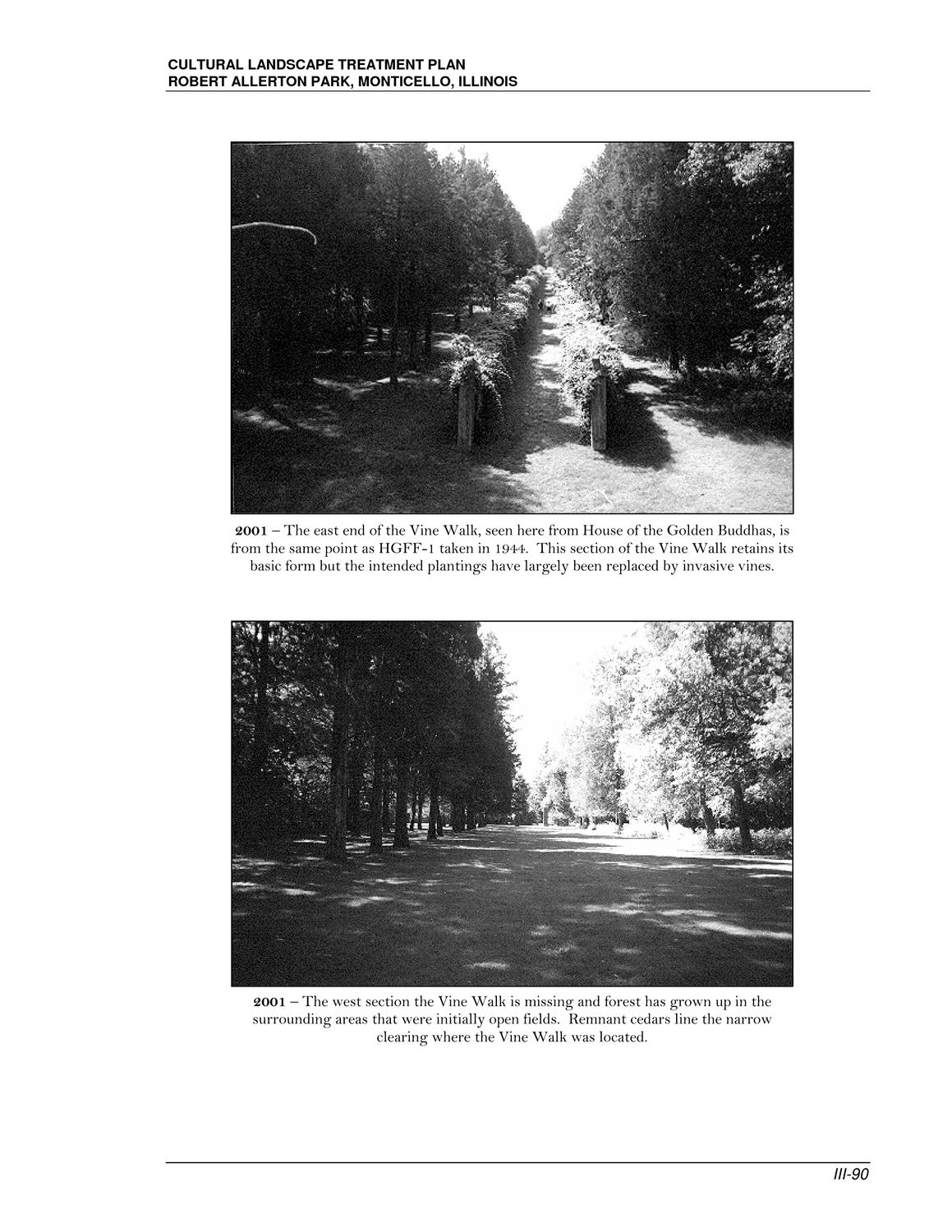
CULTURAL LANDSCAPE TREATMENT PLAN ROBERT ALLERTON PARK, MONTICELLO, ILLINOIS 2001 – The east end of the Vine Walk, seen here from House of the Golden Buddhas, is from the same point as HGFF-1 taken in 1944. This section of the Vine Walk retains its basic form but the intended plantings have largely been replaced by invasive vines. 2001 – The west section the Vine Walk is missing and forest has grown up in the surrounding areas that were initially open fields. Remnant cedars line the narrow clearing where the Vine Walk was located. III-90
|