Caption: Map of UIUC (1999) (South Campus)
This is a reduced-resolution page image for fast online browsing.
EXTRACTED TEXT FROM PAGE:
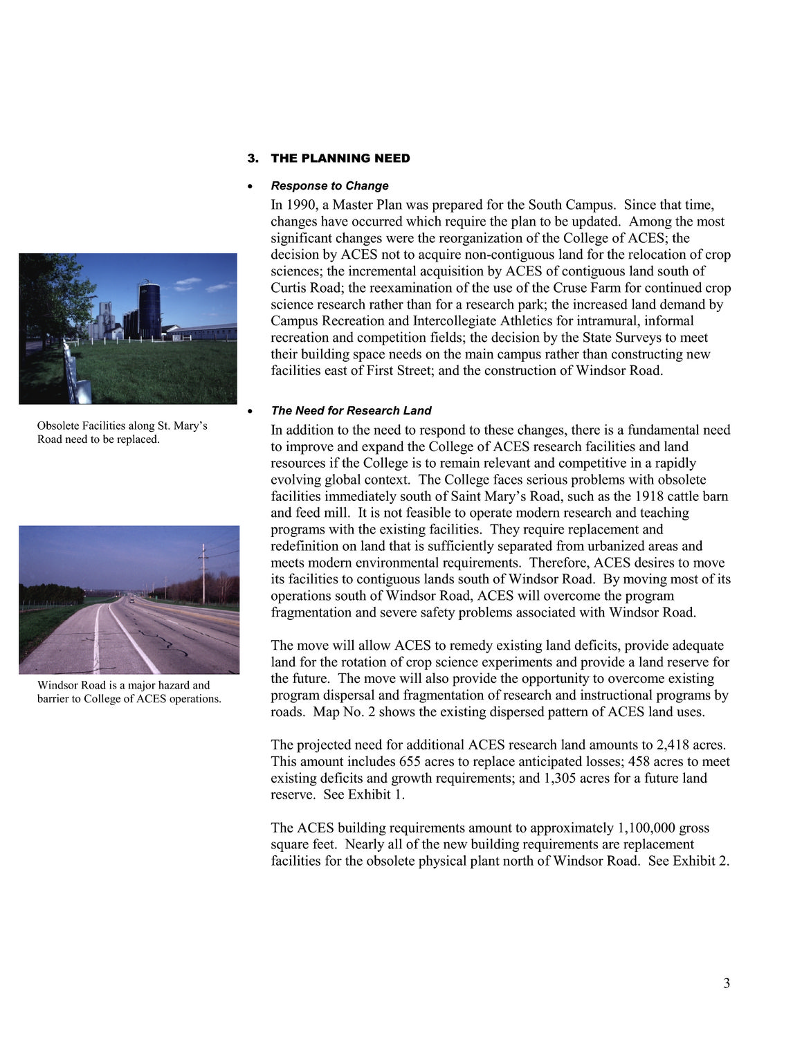
3. THE PLANNING NEED • Response to Change In 1990, a Master Plan was prepared for the South Campus. Since that time, changes have occurred which require the plan to be updated. Among the most significant changes were the reorganization of the College of ACES; the decision by ACES not to acquire non-contiguous land for the relocation of crop sciences; the incremental acquisition by ACES of contiguous land south of Curtis Road; the reexamination of the use of the Cruse Farm for continued crop science research rather than for a research park; the increased land demand by Campus Recreation and Intercollegiate Athletics for intramural, informal recreation and competition fields; the decision by the State Surveys to meet their building space needs on the main campus rather than constructing new facilities east of First Street; and the construction of Windsor Road. • The Need for Research Land Obsolete Facilities along St. Mary’s Road need to be replaced. In addition to the need to respond to these changes, there is a fundamental need to improve and expand the College of ACES research facilities and land resources if the College is to remain relevant and competitive in a rapidly evolving global context. The College faces serious problems with obsolete facilities immediately south of Saint Mary’s Road, such as the 1918 cattle barn and feed mill. It is not feasible to operate modern research and teaching programs with the existing facilities. They require replacement and redefinition on land that is sufficiently separated from urbanized areas and meets modern environmental requirements. Therefore, ACES desires to move its facilities to contiguous lands south of Windsor Road. By moving most of its operations south of Windsor Road, ACES will overcome the program fragmentation and severe safety problems associated with Windsor Road. The move will allow ACES to remedy existing land deficits, provide adequate land for the rotation of crop science experiments and provide a land reserve for the future. The move will also provide the opportunity to overcome existing program dispersal and fragmentation of research and instructional programs by roads. Map No. 2 shows the existing dispersed pattern of ACES land uses. The projected need for additional ACES research land amounts to 2,418 acres. This amount includes 655 acres to replace anticipated losses; 458 acres to meet existing deficits and growth requirements; and 1,305 acres for a future land reserve. See Exhibit 1. The ACES building requirements amount to approximately 1,100,000 gross square feet. Nearly all of the new building requirements are replacement facilities for the obsolete physical plant north of Windsor Road. See Exhibit 2. Windsor Road is a major hazard and barrier to College of ACES operations. 3
|