Caption: Map of UIUC (2001) (South Campus)
This is a reduced-resolution page image for fast online browsing.
EXTRACTED TEXT FROM PAGE:
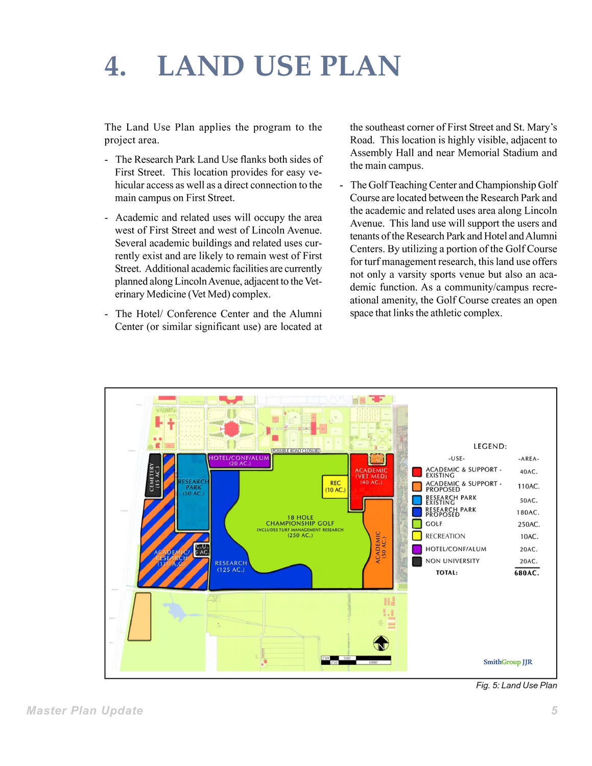
4. LAND USE PLAN the southeast corner of First Street and St. Mary’s Road. This location is highly visible, adjacent to Assembly Hall and near Memorial Stadium and the main campus. - The Golf Teaching Center and Championship Golf Course are located between the Research Park and the academic and related uses area along Lincoln Avenue. This land use will support the users and tenants of the Research Park and Hotel and Alumni Centers. By utilizing a portion of the Golf Course for turf management research, this land use offers not only a varsity sports venue but also an academic function. As a community/campus recreational amenity, the Golf Course creates an open space that links the athletic complex. The Land Use Plan applies the program to the project area. - The Research Park Land Use flanks both sides of First Street. This location provides for easy vehicular access as well as a direct connection to the main campus on First Street. - Academic and related uses will occupy the area west of First Street and west of Lincoln Avenue. Several academic buildings and related uses currently exist and are likely to remain west of First Street. Additional academic facilities are currently planned along Lincoln Avenue, adjacent to the Veterinary Medicine (Vet Med) complex. - The Hotel/ Conference Center and the Alumni Center (or similar significant use) are located at Fig. 5: Land Use Plan Master Plan Update 5
|