| |
| |
Caption: Map of UIUC (2001) (South Campus)
This is a reduced-resolution page image for fast online browsing.
EXTRACTED TEXT FROM PAGE:
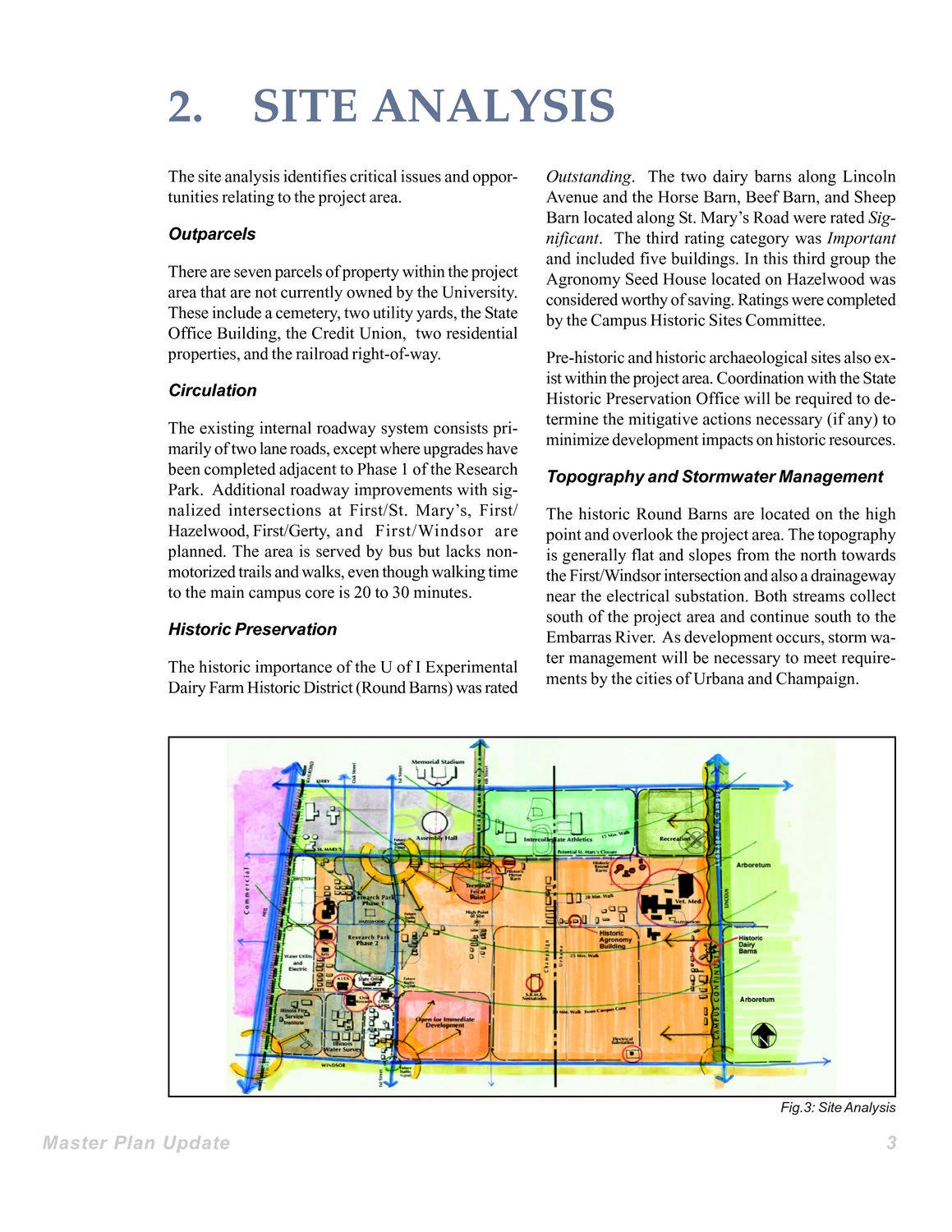
2. SITE ANALYSIS Outstanding. The two dairy barns along Lincoln Avenue and the Horse Barn, Beef Barn, and Sheep Barn located along St. Mary’s Road were rated Significant. The third rating category was Important and included five buildings. In this third group the Agronomy Seed House located on Hazelwood was considered worthy of saving. Ratings were completed by the Campus Historic Sites Committee. Pre-historic and historic archaeological sites also exist within the project area. Coordination with the State Historic Preservation Office will be required to determine the mitigative actions necessary (if any) to minimize development impacts on historic resources. Topography and Stormwater Management The historic Round Barns are located on the high point and overlook the project area. The topography is generally flat and slopes from the north towards the First/Windsor intersection and also a drainageway near the electrical substation. Both streams collect south of the project area and continue south to the Embarras River. As development occurs, storm water management will be necessary to meet requirements by the cities of Urbana and Champaign. The site analysis identifies critical issues and opportunities relating to the project area. Outparcels There are seven parcels of property within the project area that are not currently owned by the University. These include a cemetery, two utility yards, the State Office Building, the Credit Union, two residential properties, and the railroad right-of-way. Circulation The existing internal roadway system consists primarily of two lane roads, except where upgrades have been completed adjacent to Phase 1 of the Research Park. Additional roadway improvements with signalized intersections at First/St. Mary’s, First/ Hazelwood, First/Gerty, and First/Windsor are planned. The area is served by bus but lacks nonmotorized trails and walks, even though walking time to the main campus core is 20 to 30 minutes. Historic Preservation The historic importance of the U of I Experimental Dairy Farm Historic District (Round Barns) was rated Fig.3: Site Analysis Master Plan Update 3
| |