| |
| |
Caption: Map of UIUC (2001) (South Campus)
This is a reduced-resolution page image for fast online browsing.
EXTRACTED TEXT FROM PAGE:
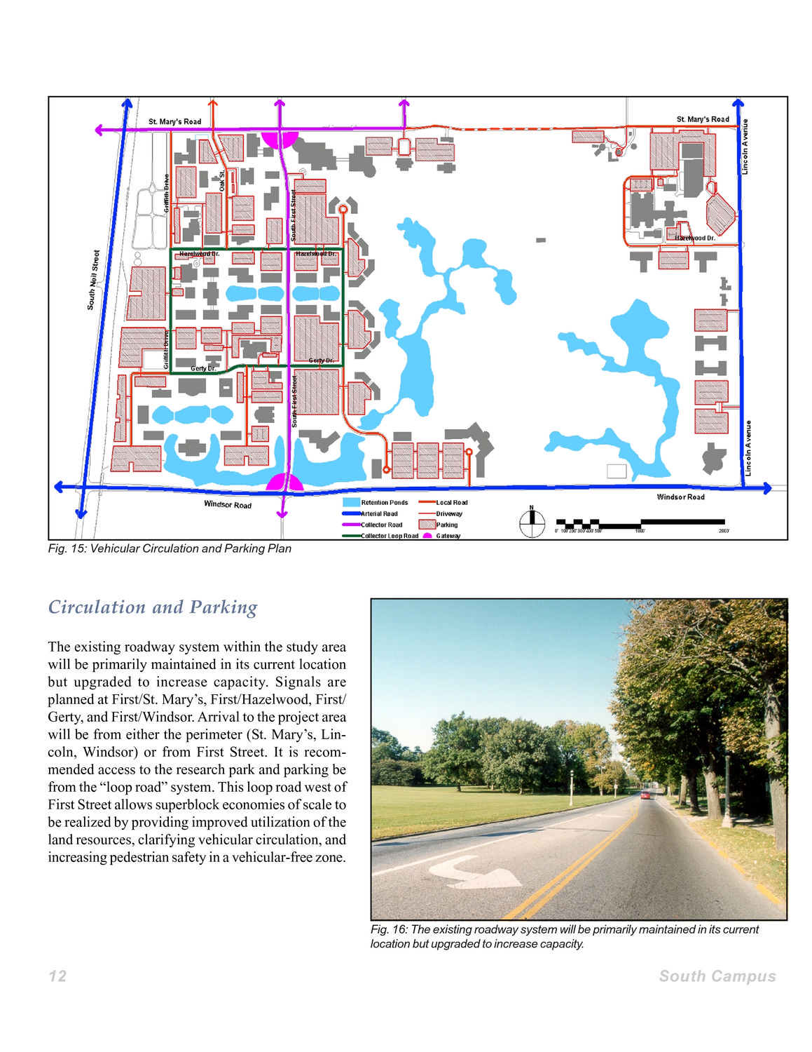
Fig. 15: Vehicular Circulation and Parking Plan Circulation and Parking The existing roadway system within the study area will be primarily maintained in its current location but upgraded to increase capacity. Signals are planned at First/St. Mary’s, First/Hazelwood, First/ Gerty, and First/Windsor. Arrival to the project area will be from either the perimeter (St. Mary’s, Lincoln, Windsor) or from First Street. It is recommended access to the research park and parking be from the “loop road” system. This loop road west of First Street allows superblock economies of scale to be realized by providing improved utilization of the land resources, clarifying vehicular circulation, and increasing pedestrian safety in a vehicular-free zone. Fig. 16: The existing roadway system will be primarily maintained in its current location but upgraded to increase capacity. 12 South Campus
| |