| |
| |
Caption: Course Catalog - 1882-1883
This is a reduced-resolution page image for fast online browsing.
EXTRACTED TEXT FROM PAGE:
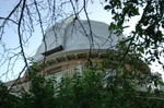
46 Illinois Industrial University. will enable him to pursue his professional studies with greater ease and advantage. With this view, the subjects peculiar to civil engineering are not introduced until the second year. The instruction is given by lectures, text books and reading, to which are added numerous problems and practical exercises, as serving best to completely explain subjects and fix them in the mind. Models and instruments are continually used, both in lectures and by the students themselves. COUKSE OF STUDIES. The complete course occupies four years. The studies of the first three years will prepare students for undertaking many engineering operations, such as making land and topographical surveys, building railroads, canals, embankments, etc. The fourth year is intended to fit them for higher engineering operations, such as making geodetic surveys building arches, trussed bridges, and supporting frames of all kinds. The order of studies as given by the year and term in the tabular view of the course, should be closely followed, so that the stud-ent may avoid interference of hours of recitation and because the studies are there given in that order which best meets the preparation of the student. TECHNICAL STUDIES. Astronomy—Descriptive Astronomy is given with a text book. The equatorial telescope is in constant use during favorable weather. Practical astronomy is given by lectures and practical work with the altazimuth instrument, the astronomical transit, the sextant, and the engineer's transit adapted to astronomical work, and by astronomical calculations. It includes the instruments and their adjustment, the determination of time, latitude, longitude, and azimuth. Bridges—Calculations of stresses in the various forms of bridge-trusses, by algebraic and graphical methods, consideration being given to weights of bridge and train, and force of wind; designing trusses, and proportioning sections. Geoiesy—Spirit, barometrical, and trigonometrical leveling; base lines, stations, and triangulation; parallels and meridians; projection of maps. Land Surveying—Areas and distances, by chain, compass, and plane table; omissions and corrections; metrical system; methods of U. S. public land surveys; magnetic variation; determination of true meridian. Rail-road Surveying—Economic location; curves and grades, and their inter-adjustment; earthwork; curvature and elevation of rail; easement curves; turnouts; crossings; maintenance of way.
| |